First some stats and history: Mount Hood is 11,237 feet tall (or 3,426 meters if you prefer). It is a stratovolcano -- that is, a volcano composed of explosively erupted cinders and ash with occasional lava flows. Mount Hood's main cone is about 500,000 years old. Regarding its volcanic history, it has had only four eruptive periods in the last 15,000 years. The most "recent" of those was 250-180 years ago. Though its eruptions have been few and far between, future volcanic activity is not outside the realm of possibility and would endanger the communities on its flank.
We began our hike at the Timberline Lodge, a National Historic Landmark completed in 1938 as a WPA project during the Depression. It is a magnificent structure which speaks to the rugged elegance of the high peaks of the western United States. Poke around the Timberline Lodge website and you will see exactly what I mean.
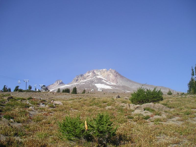
We began our day riding the ski lift which originates just east of the lodge. This lift, according to Alpenglow Ski History, was built in 1938 and was probably the second chairlift in America, following the one in Sun Valley which was built in 1936. The Mount Hood lift was named the Magic Mile because it originated above treeline and extended for nearly a mile. Fascinating details on its construction are described by Thomas P. Deering, Jr. in his 1986 Master's thesis entitled Mountain Architecture: An Alternative Design Proposal for the Wy'East Day Lodge, Mount Hood Oregon (Master of Architecture Thesis, University of Washington). The lift we took is actually the third incarnation of the Magic Mile chairlift. Like the original, it originates at 5,924 feet and took us up to the small buildings in the middle of the mountain slope, just beneath the glacier. (It's easier to see the buildings if you click on the picture to make it larger.) The elevation of those buildings is 7,015 feet.
At the higher elevation, the glaciers were accessible. My son hiked on the nearest glacier for a bit.

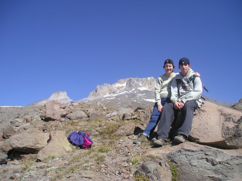
We all hiked upwards from the chairlift. Here is a picture of me and my son at about 7,600 feet with Mount Hood's peak still 4,000 feet above us.
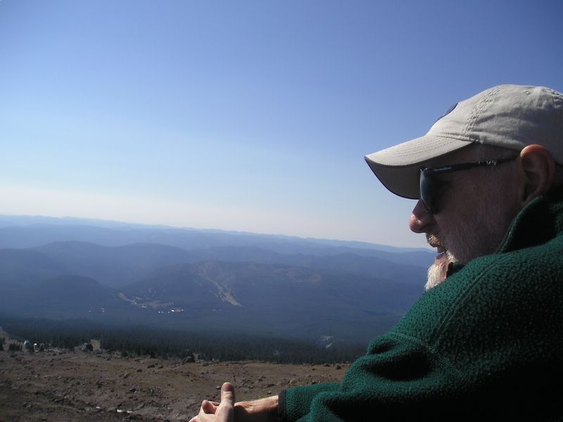
Here is my husband looking at the view from the chairlift.
At about 6000 feet, we hiked the Timberline Trail through wooded areas . . .

and through two glacial canyons - the Sand and the Little Zigzag. Here are my husband and son on their way out of Little Zigzag Canyon. The camera angle makes this canyon looks enormous, but keep in mind its name.

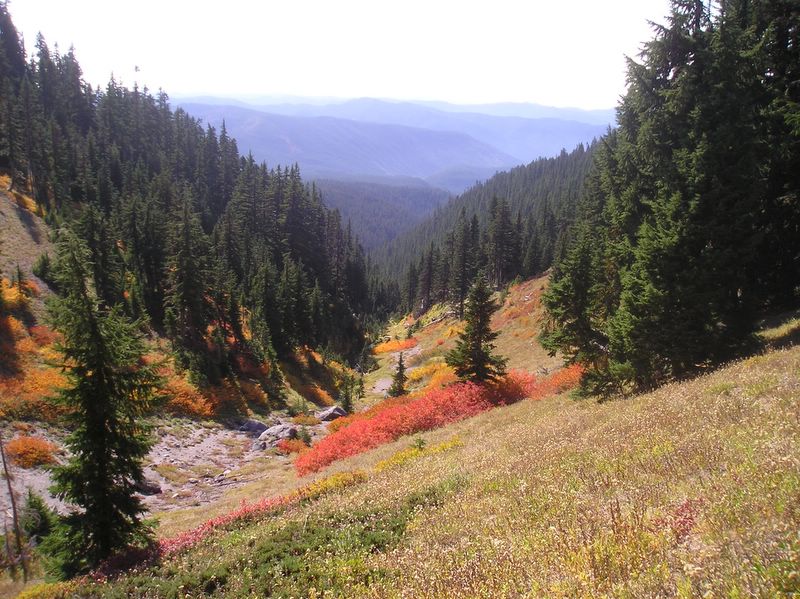
Next we went through an area where shrubs provided beautiful fall colors to contrast with the evergreens.
The enormous expanse of the (big) Zigzag Canyon with its 750 foot drop down to the Zigzag River was breathtaking. We lingered here for some time - soaking in the splendor, eating our apples and trail mix, and taking some pictures. Who could resist?

After the hike we returned tired and hungry to the Timberline Lodge and found ourselves some comfortable sofas with an exquisite mountain view in the Rams Head Bar. We ordered hearty sandwiches with mulled cider and Guinness and remained there gazing out at the snowy peak long after we finished our meal. My son drove us back to the motel where we all fell exhausted into bed, satisfied with our efforts and the time spent together.
(All the photos in this post are mine.)
© 2006, Linda Mason Hood
Truffles, Turtles & Tunes Copyright Statement


No comments:
Post a Comment